com.esri.map
Class CSVLayer

java.lang.Object
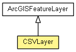
  extended by com.esri.map.Layer
      extended by com.esri.map.GraphicsLayer
          extended by com.esri.map.ArcGISFeatureLayer
              extended by com.esri.map.CSVLayer
All Implemented Interfaces:
TimeAwareLayer

public class CSVLayer
extends ArcGISFeatureLayer


Nested Class Summary
static class CSVLayer.CSVConfig
          Configuration for the CSV type feature layer.
 
Nested classes/interfaces inherited from class com.esri.map.ArcGISFeatureLayer
ArcGISFeatureLayer.EditCapabilities, ArcGISFeatureLayer.MODE, ArcGISFeatureLayer.SELECTION_METHOD
 
Nested classes/interfaces inherited from class com.esri.map.Layer
Layer.LayerStatus
 
Field Summary
 
Fields inherited from class com.esri.map.ArcGISFeatureLayer
_isEditable
 
Fields inherited from class com.esri.map.Layer
_credentials, _progress, _resolutionList, serviceInfo
 
Constructor Summary
CSVLayer(String layerDef, CSVLayer.CSVConfig config)
          The Constructor.
 
Method Summary
protected  void internalInit()
           
protected  void startlisteningToMapEvents(JMap map)
          Starts this layer listening to map events.
protected  void stopListeningToMapEvents(JMap map)
          Stops this layer listening to map events.
 
Methods inherited from class com.esri.map.ArcGISFeatureLayer
addAttachment, addAttachment, addSelectedGraphic, applyEdits, clear, clearSelection, createFeatureWithTemplate, createFeatureWithType, createFromLayerDefinition, createMode, deleteAttachments, finalize, getAttachmentURL, getAttachmentURL, getBufferFactor, getDefaultZ, getDefinitionExpression, getDisplayField, getEditCapabilities, getEditFieldsInfo, getEditInfo, getFields, getGeometryType, getLayerType, getLegendImageGeometry, getObjectIdField, getOperationMode, getOutFields, getOwnershipBasedAccessControlForFeatures, getPopupInfo, getPopupInfo, getRelationShips, getSelectedFeatures, getSubTypes, getTemplates, getTimeExtent, getTimeInfo, getTimeInterval, getTypes, hasAttachments, hasM, hasZ, initializeNativeLayer, initLayerInfo, isDefaultZEnabled, isEditable, isTable, isTimeAware, queryAttachmentInfos, queryFeatures, queryRelatedRecords, recycle, refresh, requery, retrieveAttachment, selectFeatures, setBufferFactor, setDefinitionExpression, setDynamicLayerInfo, setOperationMode, setOutFields, setTimeInterval, updateSpatialReferenceStatus, validateMapTip
 
Methods inherited from class com.esri.map.GraphicsLayer
addGraphic, addGraphics, attributesToJson, bringToFront, createNativeLayer, createSymbolImage, createSymbolImages, generateLegendInfo, getGraphic, getGraphicIDs, getGraphicIDs, getGraphicIDs, getLegend, getLegendImageGeometryByType, getMapTip, getMaxDrawOrder, getMaxScale, getMinDrawOrder, getMinScale, getNumberOfGraphics, getRenderer, getSelectionColor, getSelectionIDs, getSelectionSymbol, init, initLayer, isGraphicSelected, movePointGraphic, removeAll, removeGraphic, select, sendToBack, setGraphicVisible, setMapTip, setMaxScale, setMinScale, setRenderer, setSelectionColor, setSelectionIDs, setSelectionSymbol, unselect, updateGraphic, updateGraphic, updateGraphic, updateGraphic, updateGraphic, updateGraphic, updateGraphic, updateGraphic
 
Methods inherited from class com.esri.map.Layer
addLayerInitializeCompleteListener, fireLayerCreateCompleteEvent, fireLayerCreateErrorEvent, fireLayerCreateErrorEvent, getCopyrightText, getCredentialsInternal, getDefaultSpatialReference, getDescription, getException, getExtent, getFullExtent, getInitialExtent, getInitializationError, getLayerHandle, getMap, getMapServer, getMapServerInfo, getMapServerLegendInfo, getName, getOpacity, getResolution, getResolutionList, getServiceDescription, getSpatialReference, getStatus, getUrl, getUrlHashCode, initializeAsync, internalGetLayerLegendInfos, isHidingNoDataTiles, isInitialized, isReady, isShowingCopyright, isVisible, loadServiceInfo, lock, reinitializeAsync, removeLayerInitializeCompleteListener, setCopyrightText, setCredentials, setDefaultSpatialReference, setDescription, setError, setException, setFullExtent, setInitialExtent, setLayerHandle, setMap, setMapServer, setName, setOpacity, setPopupInfos, setServiceDescription, setShowingCopyright, setStatus, setUrl, setVisible, unlock
 
Methods inherited from class java.lang.Object
clone, equals, getClass, hashCode, notify, notifyAll, toString, wait, wait, wait
 

Constructor Detail

CSVLayer

public CSVLayer(String layerDef,
                CSVLayer.CSVConfig config)
         throws Exception
The Constructor.

Parameters:
layerDef - the layer def
config - the config
Throws:
Exception
Since:
2.0
Method Detail

internalInit

protected void internalInit()
Overrides:
internalInit in class ArcGISFeatureLayer

startlisteningToMapEvents

protected void startlisteningToMapEvents(JMap map)
Description copied from class: ArcGISFeatureLayer
Starts this layer listening to map events.

Overrides:
startlisteningToMapEvents in class ArcGISFeatureLayer
Parameters:
map - The map to listen to.

stopListeningToMapEvents

protected void stopListeningToMapEvents(JMap map)
Description copied from class: ArcGISFeatureLayer
Stops this layer listening to map events.

Overrides:
stopListeningToMapEvents in class ArcGISFeatureLayer
Parameters:
map - The map to stop listening to.


Copyright © 2012. All Rights Reserved.