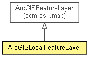
 com.esri.map.Layer
 com.esri.map.GraphicsLayer
 com.esri.map.ArcGISFeatureLayer
 com.esri.client.local.ArcGISLocalFeatureLayer
|
||||||||||
| PREV CLASS NEXT CLASS | FRAMES NO FRAMES | |||||||||
| SUMMARY: NESTED | FIELD | CONSTR | METHOD | DETAIL: FIELD | CONSTR | METHOD | |||||||||
java.lang.Objectcom.esri.map.Layer
com.esri.map.GraphicsLayer
com.esri.map.ArcGISFeatureLayer
com.esri.client.local.ArcGISLocalFeatureLayer
public class ArcGISLocalFeatureLayer

Class representing an ArcGIS feature layer on the LocalServer.
ArcGISLocalFeatureLayer is a type of GraphicsLayer
that allows you to display, select and query graphic features which consist
of geometry and attributes. Features can be edited via a
LocalFeatureService. This layer is initialized with the path to
a locally held map package, that is an MPK file and with the layer's integer
ID or name.
| Nested Class Summary |
|---|
| Nested classes/interfaces inherited from class com.esri.map.ArcGISFeatureLayer |
|---|
ArcGISFeatureLayer.EditCapabilities, ArcGISFeatureLayer.MODE, ArcGISFeatureLayer.SELECTION_METHOD |
| Nested classes/interfaces inherited from class com.esri.map.Layer |
|---|
Layer.LayerStatus |
| Field Summary |
|---|
| Fields inherited from class com.esri.map.ArcGISFeatureLayer |
|---|
_isEditable |
| Fields inherited from class com.esri.map.Layer |
|---|
_credentials, _progress, _resolutionList, serviceInfo |
| Constructor Summary | |
|---|---|
ArcGISLocalFeatureLayer(String path,
                        int layer)
Constructs from a path and a layer ID. |
|
ArcGISLocalFeatureLayer(String path,
                        int layer,
                        boolean editable)
Constructs from a path to an MPK file, a layer ID and an indication of whether features can be edited. |
|
ArcGISLocalFeatureLayer(String path,
                        String layer)
Constructs from a path to an MPK file and a layer name. |
|
ArcGISLocalFeatureLayer(String path,
                        String layer,
                        boolean editable)
Constructs from a path to an MPK file, a layer name and an indication of whether features can be edited. |
|
| Method Summary | |
|---|---|
int |
getMaximumRecords()
Gets the maximum number of records that the feature layer can return. |
LocalMapService |
getSource()
Gets the LocalMapService or LocalFeatureService to which
this layer belongs to. |
protected void |
internalInit()
|
void |
setMaximumRecords(int maxRecords)
Sets the maximum records that the feature layer can return. |
void |
setUrl(String url)
Sets the URL of the map service associated with the layer. |
| Methods inherited from class java.lang.Object |
|---|
clone, equals, getClass, hashCode, notify, notifyAll, toString, wait, wait, wait |
| Constructor Detail |
|---|
public ArcGISLocalFeatureLayer(String path,
                               String layer)
path - Path to the data.layer - Name of a layer.
public ArcGISLocalFeatureLayer(String path,
                               String layer,
                               boolean editable)
path - Path to the data.layer - Name of a layer.editable - True if the layer is to allow feature edits.
public ArcGISLocalFeatureLayer(String path,
                               int layer)
path - Path to the data.layer - ID of a layer. IDs start at 0 and are unique for each layer
from the service.
public ArcGISLocalFeatureLayer(String path,
                               int layer,
                               boolean editable)
path - Path to the data.layer - ID of a layer. IDs start at 0 and are unique for each layer
from the service.editable - True if the layer is to allow edits.| Method Detail |
|---|
public LocalMapService getSource()
LocalMapService or LocalFeatureService to which
this layer belongs to.
public void setUrl(String url)
Layer
setUrl in class Layerurl - the URL pointing to your map service.protected void internalInit()
internalInit in class ArcGISFeatureLayerpublic void setMaximumRecords(int maxRecords)
maxRecords - the number of records recordspublic int getMaximumRecords()
|
||||||||||
| PREV CLASS NEXT CLASS | FRAMES NO FRAMES | |||||||||
| SUMMARY: NESTED | FIELD | CONSTR | METHOD | DETAIL: FIELD | CONSTR | METHOD | |||||||||