| Visual Basic (Declaration) | |
|---|---|
Public MustInherit Class DynamicMapServiceLayer Inherits DynamicLayer | |
| C# | |
|---|---|
public abstract class DynamicMapServiceLayer : DynamicLayer | |
Implement this class if you want to create a custom dynamic layer where the generated image can be reached by a URL to a service of file hosted online. Note that if you want to manipulate the image, generate it on the client or manually handle download of the image you should instead implement DynamicLayer.
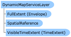
As a minimum this layer must implement GetUrl and set the Layer.FullExtent to the extent of the layer. The FullExtent should include a default SpatialReference for the layer. The map uses this to determine when to draw the layer.
When overriding Layer.Initialize you should always call base.Initialize(). If you require doing an asynchronous request (ie download metadata about the service), you should call base.Initialize() after the processing has completed. The Map wil not render the layer until Initialize has been called. If an error occurs in initialization set the Layer.InitializationFailure property with the exception and still call base.Initialize() afterwards.
Creating a dynamic layer using a simple map rendering webservice:
            public class MyLayer : DynamicMapServiceLayer
            {
              public override void Initialize()
              {
                this.FullExtent = new Envelope(-180,-90,180,80) { SpatialReference = new SpatialReference(4326) };
                this.SpatialReference = new SpatialReference(4326);
                base.Initialize();
              }
              public override void GetUrl(Envelope extent, int width, int height, OnUrlComplete onComplete)
              {
                if (extent.SpatialReference != null && extent.SpatialReference.WKID != 4326)
                  throw new NotSupportedException("SRID not supported");
                onComplete(string.Format(CultureInfo.InvariantCulture, "http://myserver/service.ashx?box={0},{1},{2},{3}&w={4}&h={5}",
                  extent.XMin, extent.YMin, extent.XMax, extent.YMax, width, height),
                  width, height, extent);
              }
            }
System.Object
System.Windows.DependencyObject
ESRI.ArcGIS.Client.Layer
ESRI.ArcGIS.Client.DynamicLayer
ESRI.ArcGIS.Client.DynamicMapServiceLayer
ESRI.ArcGIS.Client.ArcGISDynamicMapServiceLayer
ESRI.ArcGIS.Client.ArcGISImageServiceLayer
ESRI.ArcGIS.Client.Tasks.GPResultImageLayer
ESRI.ArcGIS.Client.Toolkit.DataSources.WmsLayer
Target Platforms: Windows XP Professional, Windows Server 2003 family, Windows Vista, Windows Server 2008 family, Windows 7


