Description
When used in a map file (*.apm), it defines the characteristics of one of the map layers.
Diagram
Overview
 |
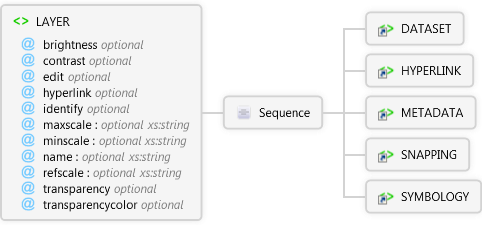
LAYER
When used in a map file (*.apm), it defines the characteristics of one of the map layers.
 |
brightness optional Restriction of xs:int
whiteness of the layer, negative values increase the darkness of the layer.
|
|
contrast optional Restriction of xs:int
Contrast adjustment for the layer. Positive values exaggerate color separation (as the value approaches 1, the result is either pure black (for colors below the grey threshold) or pure solid color (for colors above the threshold), for example, a dark red will become pitch black, whereas a bright red will become solid red). Negative values merge/dissolve the colors (as the value approaches -1, the result is all gray).
|
|
edit optional Restriction of xs:string
Specifies whether the layer can be edited.
|
|
hyperlink optional Restriction of xs:string
Specifices whether the hyperlink tool can be used with the layer.
|
|
identify optional Restriction of xs:string
Specifies whether the identify tool can be used with the layer.
|
|
maxscale optional xs:string
Maximum scale to display the layer using a relative scale such as 1:24000.
|
|
minscale optional xs:string
Minimum scale to display the layer using a relative scale such as 1:24000.
|
|
name optional xs:string
Name of the layer. Can be an alias.
|
|
refscale optional xs:string
Reference scale to display the symbology for the layer. The scale is specfied using a relative scale such as 1:24000. Symbols are scaled relative to the refscale as the map is zoomed in or out.
|
|
transparency optional Restriction of xs:int
Transparency percentage for the layer (0 = 100 % transparent; 1 = 100 % opaque).
|
|
transparencycolor optional
Transparency color for the layer. This color will be rendered transparent in the map.
|
 |
Sequence
 |
DATASET
Specifies the pathname of a layer in an ArcPad map file (*.apm).
|
|
HYPERLINK
Used to specify the hyperlink properties of a layer in an ArcPad layer definition or ArcPad map file (*.apm).
|
|
METADATA
The parent element for layer meta data.
|
|
SNAPPING
Used to specify the snapping settings for a layer in layer definitions and map files (*.apm).
|
|
SYMBOLOGY
The parent element for symbology in an ArcPad map file (*.apm).
|
|
|
Attributes
| Name | Type | Use | Default | Fixed | Description |
|---|
| brightness | Restriction of xs:int | optional | 0 | | whiteness of the layer, negative values increase the darkness of the layer. |
| contrast | Restriction of xs:int | optional | 0 | | Contrast adjustment for the layer. Positive values exaggerate color separation (as the value approaches 1, the result is either pure black (for colors below the grey threshold) or pure solid color (for colors above the threshold), for example, a dark red will become pitch black, whereas a bright red will become solid red). Negative values merge/dissolve the colors (as the value approaches -1, the result is all gray). |
| edit | Restriction of xs:string | optional | false | | Specifies whether the layer can be edited. |
| hyperlink | Restriction of xs:string | optional | false | | Specifices whether the hyperlink tool can be used with the layer. |
| identify | Restriction of xs:string | optional | false | | Specifies whether the identify tool can be used with the layer. |
| maxscale | xs:string | optional | | | Maximum scale to display the layer using a relative scale such as 1:24000. |
| minscale | xs:string | optional | | | Minimum scale to display the layer using a relative scale such as 1:24000. |
| name | xs:string | optional | | | Name of the layer. Can be an alias. |
| refscale | xs:string | optional | | | Reference scale to display the symbology for the layer. The scale is specfied using a relative scale such as 1:24000. Symbols are scaled relative to the refscale as the map is zoomed in or out. |
| transparency | Restriction of xs:int | optional | 1 | | Transparency percentage for the layer (0 = 100 % transparent; 1 = 100 % opaque). |
| transparencycolor | | optional | | | Transparency color for the layer. This color will be rendered transparent in the map. |
Source
<xs:element name="LAYER" xmlns:xs="http://www.w3.org/2001/XMLSchema">
  <xs:annotation>
    <xs:documentation>When used in a map file (*.apm), it defines the characteristics of one of the map layers.</xs:documentation>
  </xs:annotation>
  <xs:complexType>
    <xs:sequence>
      <xs:element ref="apm:DATASET" />
      <xs:element ref="apm:HYPERLINK">
        <xs:annotation>
          <xs:documentation>Used to specify the hyperlink properties of a layer in an ArcPad layer definition or ArcPad map file (*.apm).</xs:documentation>
        </xs:annotation>
      </xs:element>
      <xs:element ref="apm:METADATA" />
      <xs:element ref="apm:SNAPPING" />
      <xs:element ref="apm:SYMBOLOGY" />
    </xs:sequence>
    <xs:attribute name="brightness" default="0">
      <xs:annotation>
        <xs:documentation>whiteness of the layer, negative values increase the darkness of the layer.</xs:documentation>
      </xs:annotation>
      <xs:simpleType>
        <xs:restriction base="xs:int">
          <xs:minInclusive value="-1" />
          <xs:maxInclusive value="1" />
        </xs:restriction>
      </xs:simpleType>
    </xs:attribute>
    <xs:attribute name="contrast" default="0">
      <xs:annotation>
        <xs:documentation>Contrast adjustment for the layer. Positive values exaggerate color separation (as the value approaches 1, the result is either pure black (for colors below the grey threshold) or pure solid color (for colors above the threshold), for example, a dark red will become pitch black, whereas a bright red will become solid red). Negative values merge/dissolve the colors (as the value approaches -1, the result is all gray).</xs:documentation>
      </xs:annotation>
      <xs:simpleType>
        <xs:restriction base="xs:int">
          <xs:minInclusive value="-1" />
          <xs:maxInclusive value="1" />
        </xs:restriction>
      </xs:simpleType>
    </xs:attribute>
    <xs:attribute default="false" name="edit">
      <xs:annotation>
        <xs:documentation>Specifies whether the layer can be edited.</xs:documentation>
      </xs:annotation>
      <xs:simpleType>
        <xs:restriction base="xs:string">
          <xs:enumeration value="true" />
          <xs:enumeration value="false" />
        </xs:restriction>
      </xs:simpleType>
    </xs:attribute>
    <xs:attribute default="false" name="hyperlink">
      <xs:annotation>
        <xs:documentation>Specifices whether the hyperlink tool can be used with the layer.</xs:documentation>
      </xs:annotation>
      <xs:simpleType>
        <xs:restriction base="xs:string">
          <xs:enumeration value="true" />
          <xs:enumeration value="false" />
        </xs:restriction>
      </xs:simpleType>
    </xs:attribute>
    <xs:attribute default="false" name="identify">
      <xs:annotation>
        <xs:documentation>Specifies whether the identify tool can be used with the layer.</xs:documentation>
      </xs:annotation>
      <xs:simpleType>
        <xs:restriction base="xs:string">
          <xs:enumeration value="true" />
          <xs:enumeration value="false" />
        </xs:restriction>
      </xs:simpleType>
    </xs:attribute>
    <xs:attribute name="maxscale" type="xs:string">
      <xs:annotation>
        <xs:documentation>Maximum scale to display the layer using a relative scale such as 1:24000.</xs:documentation>
      </xs:annotation>
    </xs:attribute>
    <xs:attribute name="minscale" type="xs:string">
      <xs:annotation>
        <xs:documentation>Minimum scale to display the layer using a relative scale such as 1:24000.</xs:documentation>
      </xs:annotation>
    </xs:attribute>
    <xs:attribute name="name" type="xs:string">
      <xs:annotation>
        <xs:documentation>Name of the layer. Can be an alias.</xs:documentation>
      </xs:annotation>
    </xs:attribute>
    <xs:attribute name="refscale" type="xs:string">
      <xs:annotation>
        <xs:documentation>Reference scale to display the symbology for the layer. The scale is specfied using a relative scale such as 1:24000. Symbols are scaled relative to the refscale as the map is zoomed in or out.</xs:documentation>
      </xs:annotation>
    </xs:attribute>
    <xs:attribute name="transparency" default="1">
      <xs:annotation>
        <xs:documentation>Transparency percentage for the layer (0 = 100 % transparent; 1 = 100 % opaque).</xs:documentation>
      </xs:annotation>
      <xs:simpleType>
        <xs:restriction base="xs:int">
          <xs:minInclusive value="0" />
          <xs:maxInclusive value="1" />
        </xs:restriction>
      </xs:simpleType>
    </xs:attribute>
    <xs:attribute name="transparencycolor">
      <xs:annotation>
        <xs:documentation>Transparency color for the layer. This color will be rendered transparent in the map.</xs:documentation>
      </xs:annotation>
    </xs:attribute>
  </xs:complexType>
</xs:element> |
See Also