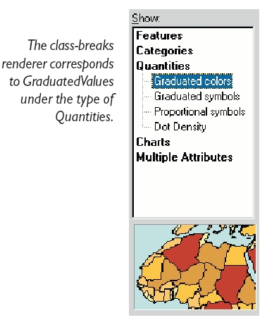
A renderer that can be used to draw graduated color (choropleth) and graduated symbol maps.
Product Availability
Available with ArcGIS Engine, ArcGIS Desktop, and ArcGIS Server.
Description
Use a ClassBreaksRenderer to symbolize quantitative
information about feature data. Class breaks symbology divides the
range of feature values into a relatively small number of classes.
For example, you can use a ClassBreaksRenderer to symbolize
features by population value, dividing the features into three
classes of low, medium, and high population value.
One symbol is associated with each class, and it is used
to draw features in the class. For example, with a polygon feature
class, a yellow fill symbol can represent low population, orange
fill can represent medium population, and red fill can represent
high population.
The ClassBreaksRenderer works well also with
other feature types. For example, a line feature class representing
roads with associated numeric values for traffic density can be
rendered using different colors for high, medium, and low traffic.
Also, city points can be classified with a range of circular marker
symbols with different sizes or colors (or both) based on
population.
Classes are defined by specifying the break values between the
classes. You can set class breaks manually to define these classes,
or you can generate a list of class breaks using
IClassify and one of the ESRI classification
objects (e.g. Quantile,
NaturalBreaks). Use a histogram objects (e.g.
TableHistogram, BasicTableHistogram, DataHistogram) to set data to
a classification object.
Supported Platforms
Windows, Solaris, Linux
Interfaces
| Interfaces | Description |
|---|---|
| IBarrierProperties2 | Provides access to members that control how objects (text, features, graphics) act as barriers for labelling with the cancel tracker. |
| IClassBreaksRenderer | Provides access to members that control a renderer which is used to draw graduated color (choropleth) and graduated symbol maps. |
| IClassBreaksUIProperties | Provides access to members that control some user interface properties of a ClassBreaksRenderer. The properties set through this interface do NOT affect what is drawn on the map. |
| IClassBreaksUIProperties2 | Provides access to members that control some user interface properties of a ClassBreaksRenderer. The properties set through this interface do NOT affect what is drawn on the map. |
| IDataExclusion | Provides access to members that control the exclusion of data values from a renderer. |
| IDataExclusion2 | Provides access to members that control the exclusion of data values from a renderer. |
| IDataNormalization | Provides access to members that control the data normalization properties of a renderer. |
| IDataSampling | Provides access to members that control the data sampling properties of a renderer. |
| IExportSupport | Provides access to export support members. |
| IFeatureRenderer | Provides access to members that control functionality common to all feature renderers. |
| IFeatureRendererUpdate | Provides access to members that control functionality common to all feature renderers. |
| ILegendInfo | Provides access to members that control legend information provided by a renderer. |
| ILevelRenderer | Provides access to members that control the drawing of symbols for features, where symbols are separated into levels, and each level drawn separately. |
| ILookupLegendClass | Provides access to functionality for looking up a renderer's legend class via a feature. |
| ILookupSymbol | Provides access to functionality for looking up a renderer's symbol via a feature. |
| IPersist | Defines the single method GetClassID, which is designed to supply the CLSID of an object that can be stored persistently in the system. IPersist is the base interface for three other interfaces: IPersistStorage, IPersistStream, and IPersistFile. |
| IPersistStream (esriSystem) | |
| IRendererClasses | Provides access to members that provides the information of layer annotation classes. |
| IRotationRenderer | Provides access to members that control the drawing of rotated marker symbols based on field values. |
| IRotationRenderer2 | Provides access to members that control the rotation of marker symbols based on field values, expression, or random. Used for all symbols, not just 3D; used for all apps, including ArcMap. |
| ISizeRenderer | Provides access to members that control the drawing of sized marker symbols based on field values, expression, or random. |
| IXMLSerialize (esriSystem) | Provides access to members that XML serialize and deserialize an object to/from XML. |
| IXMLVersionSupport (esriSystem) | Provides access to members that help in serializing an object to different namespaces (versions). |
See Also
ClassBreaksRenderer Class | EqualInterval Class | Quantile Class | DefinedInterval Class | StandardDeviation Class | NaturalBreaks Class