Data Appliance for ArcGIS
Data Appliance for ArcGIS is a turnkey GIS solution with much of the same data content that is available through ArcGIS Online services. The terabytes of rich, detailed data come from industry-leading data providers to enhance ArcGIS for Server applications and services. This data is designed and optimized for publishing services using a customer's existing ArcGIS for Server Advanced or Standard license. Data Appliance for ArcGIS fits easily into an existing IT infrastructure by connecting directly to the existing network. This allows you to quickly leverage the data for successful geospatial visualization and analysis.
Key Features
- Allows quick and easy publishing of large sets of useful geographic data
- Pre-rendered and optimized maps and data for high-performance publishing
- Can be deployed in a secure, private network or over the Internet
Coverage
The product is sold based on geography. The products are:
- Premier Collection : Includes all maps available on the Data Appliance worldwide at all scales.
- North America Collection : Includes all maps available on the Data Appliance at the small and medium scales. Larger scales of each map are limited to North America only. Includes the United States, Canada, Mexico, and Carribbean countries where data is available.
- Europe Collection : Includes all maps available on the Data Appliance at the small and medium scales. Larger scales of each map are limited to Europe only. Includes countries of Western and Eastern Europe. Russia includes data as far east as the Ural Mountains.
- World Small-Scale Collection : Includes all maps available on the Data Appliance at the small and medium scales only.
The following map shows the coverage for the different collections. Premier and World Small-Scale are worldwide. The regions that make up the North America and Europe Collections are highlighted in green.

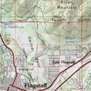
Maps on the Data Appliance
The following are the most popular maps delivered with the Data Appliance for ArcGIS. Depending on the collection purchased, the level of detail differs.
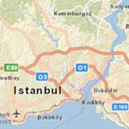
This map presents a street map with highway-level data for the world. | 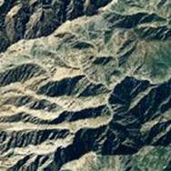 This map presents satellite imagery for the world. | 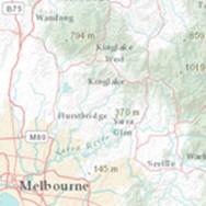 This map includes administrative boundaries, cities, water features, physiographic features, parks, landmarks, highways, roads, railways, and airports. |
 This map is designed to be used as a general reference map for informational and educational purposes as well as a basemap by GIS professionals and other users. | World Light Gray Base (Canvas Map)  This basemap provides a neutral background for your data with minimal colors, labels, and features. | 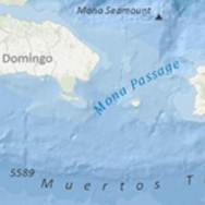
Ocean Basemap includes bathymetry, surface and subsurface feature names, and derived depths. |
 This map presents land-cover imagery for the world and detailed topographic maps for the United States at various scales. | 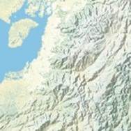 This map presents the Natural Earth physical map for the world. | 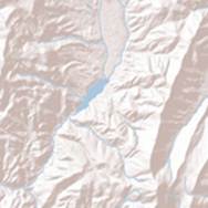 This map portrays surface elevation as shaded relief. It is intended for use as a basemap layer to add shaded relief to other GIS maps. |