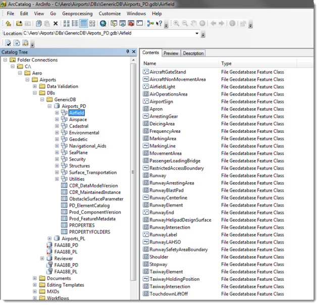
Airport Data Model
ArcGIS for Aviation: Airports includes a ready-to-use airports data model eliminating the need for time consuming and expensive data modeling activities. The airports data model integrates the FAA's Advisory Circular 150/5300-18 template which draws from industry standards such as the Aeronautical Information Exchange Model (AIXM), Federal Geographic Data Committee (FGDC), and Spatial Data Standards for Facilities, Infrastructure, and Environment (SDSFIE). All airports have unique data management requirements; the airports data model can be extended and customized to meet your individual operational objectives.
Related Links:
Data Validation Checks
ArcGIS for Aviation: Airports includes the ArcGIS Data Reviewer extension for data quality control. It provides a series of tools that support both automated and visual quality control of your data. You can detect both spatial and attribute anomalies for features and relationships in your database. Data checks can be scheduled to run automatically or on an as-needed basis. Anomalies found are logged in a central table, which is used to manage the entire lifecycle from finding to fixing to verifying. Depending on the type of data validation you are performing, the anomaly can be corrected as part of database maintenance or investigated further.
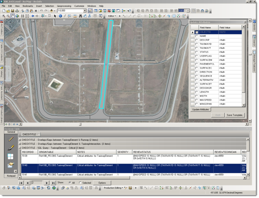
ArcGIS for Aviation: Airports includes a pre-configured ArcGIS Data Reviewer validation rule base with over 450 attribute and spatial checks.
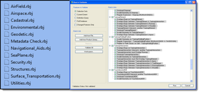
The ArcGIS for Aviation: Airports data validation rules were developed from the FAA AC 150/5300-18 specification and include many of the same checks used by the FAA to review the quality of your data upon submission. Running these automated checks on your data prior to submission prevents cumbersome and costly rework which can delay approval of associated airport projects. While the included data validation rules are quite comprehensive, they can also be modified and extended to meet your individual requirements.
Although developed to support FAA requirements, the ArcGIS for Aviation: Airports data validation rules also represent best practices related to GIS data management for airports both in the United States and internationally. The rule base provides international airports and their consultants robust and extensible data quality capabilities, supporting comparable international standards such as the Aeronautical Data Quality (ADQ) requirements adopted by the European Commission in 2010.