| URL | http://<catalog-url>/<serviceName>/FeatureServer |
|---|---|
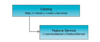
| Parent Resource | Catalog |
| Child Resources | Layer |
Description
A feature service can contain datasets (e.g. tables, views) with and without a spatial column. Datasets with a spatial column are considered layers and without a spatial column are considered tables. A feature service allows clients to query and edit feature geometry and attributes.
The REST API feature service resource represents a feature service published to an ArcGIS Spatial Data Server. This resource provides basic information about the feature service including the feature layers and tables that it contains, the service description, etc.
Resource Hierarchy
Parameters
| Parameter | Details |
|---|---|
| f | Description: The
response format. The default response format is html. Values: html | json |
Example Usage
Example 1: URL for the "USA" feature service on sampleserver10.
http://sampleserver10.arcgisonline.com/arcgis/rest/services/USA/FeatureServer?f=pjsonJSON Response Syntax
{
  "currentVersion": <currentVersion>,
  "serviceDescription": "<serviceDescription>",
  "supportsRollbackOnFailure": <true|false>,
  "hasVersionedData": <true|false>,
  "supportsDisconnectedEditing": <true|false>,
  "supportedQueryFormats": "<supportedQueryFormats>",
  "maxRecordCount": "<maxRecordCount>",
  "capabilities": "<capabilities>",
  "description": "<description>",
  "copyrightText": "<copyrightText>",
  "spatialReference": {
    <spatialReference>
  },
  "initialExtent": {
    <envelope>
  },
  "fullExtent": {
    <envelope>
  },
  "units": "<units>",
  "documentInfo": {
    "<key1>": "<value1>",
    "<key2>": "<value2>"
  },
  "layers": [
    {
      "id": <layerId1>,
      "name": "<layerName1>"
    },
    {
      "id": <layerId2>,
      "name": "<layerName2>"
    }
  ],
  "tables": [
    {
      "id": <tableId1>,
      "name": "<tableName1>"
    },
    {
      "id": <tableId2>,
      "name": "<tableName2>"
    }
  ]
}
JSON Response Example
{
  "currentVersion": 10.1,
  "serviceDescription": "Sample service",
  "supportsRollbackOnFailure": true,
  "supportsDisconnectedEditing": false,
  "maxRecordCount": 1000,
  "supportedQueryFormats": "JSON",
  "capabilities": "Create,Delete,Query,Update,Editing",
  "description": "",
  "copyrightText": "",
  "spatialReference": {
    "wkid": 102100
  },
  "initialExtent": {
    "xmin": -2045829.6562935,
    "ymin": 697643.75265551,
    "xmax": -683577.81911301,
    "ymax": 1341296.2161777,
    "spatialReference": {
      "wkid": 102100
    }
  },
  "fullExtent": {
    "xmin": -19839092.300058,
    "ymin": 2145729.68514514,
    "xmax": -7454985.17534849,
    "ymax": 11542624.9107061,
    "spatialReference": {
      "wkid": 102100
    }
  },
  "units": "esriMeters",
  "layers": [
    {
      "id": 0,
      "name": "Demo.dbo.USCITIES"
    },
    {
      "id": 1,
      "name": "Demo.dbo.USINTERSTATES"
    },
    {
      "id": 2,
      "name": "Demo.dbo.USCOUNTIES"
    }
  ],
  "tables": [

  ]
}