Densifies and reshapes existing segments so that the output segments follow the shortest ground path connecting input vertices. maxSegmentLength is in the units of the axis of the underlying spheroid of this polyline's gcs (usually meters).
[Visual Basic .NET]
Public Sub GeodesicDensify ( _
    ByVal maxSegmentLength As Double _
)
[C#]
public void GeodesicDensify (
    double maxSegmentLength
);
[C++]
HRESULT GeodesicDensify(
  double maxSegmentLength
);
[C++]Parameters
maxSegmentLength maxSegmentLength is a parameter of type double
Product Availability
Description
The GeodesicDensify method modifies a polyline or polygon by inserting vertices. The original geometry is interpreted as a sequential collection of "stops" on the Earth's surface. The inserted vertices define the shape of the shortest ground path connecting those stops. The geometry must be associated with a geographic coordinate system.
The maxSegmentLength parameter is in the units (usually meters) of the semi-major axis of the coordinate system's ellipsoid. The minimum allowable value for this parameter is 1/10,000 of the length of the semi-major axis. This minimum value will be used for densification if the input value of maxSegmentLength is less than that.
Remarks
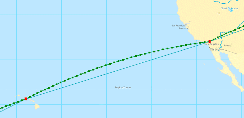
The image below shows the results of applying the GeodesicDensify method to a polyline representing a flight path with stops in Honolulu and Los Angeles. The original polyline is modified by adding additional segments that identify the shortest ground distance between these locations.