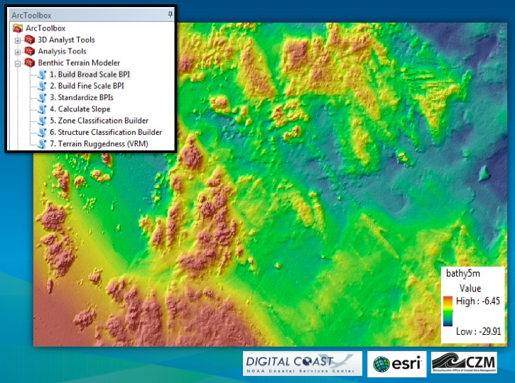
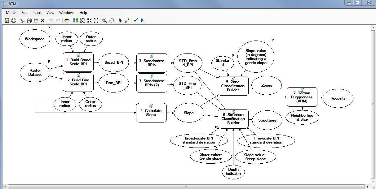
Benthic Terrain Modeler (BTM) is an application originally developed in 2005 at Oregon State University under a cooperative agreement with the NOAA Coastal Services Center's (CSC) GIS Integration and Development program (Wright et al., 2005). The application provides a set of geoprocessing tools to analyze benthic terrain for the purposes of classifying surficial seafloor characteristics that may be used in studies of benthic habitat, geomorphology, prediction of benthic fish species distribution, marine protected area design, and more. From an input grid of multibeam bathymetry the user may create additional grids of slope, bathymetric position index or BPI (a variation on the topographic position index approach of Guisan et al. 1999 and Weiss, 2001), and seafloor rugosity (after Jenness, 2003 and Iampietro and Kvitek, 2002).

An integrated XML-based terrain classification dictionary gave users the freedom to create their own classifications and define the relationships characterizing them. A unique feature of the original tool is its wizard-like functionality that stepped users through the processes involved in benthic terrain characterization, and providing access to a tutorial of geomorphological and terrain analysis concepts along the way. The tool has gained an international following in the benthic habitat mapping community (used in nearly 50 labs) and is cited in in several published studies (e.g., Diesing et al., 2009; Dunn and Halpin, 2009; Erdey-Heydorn, 2008; Lanier et al., 2007; Lundblad et al., 2006; Wedding et al., 2008; Wilson et al., 2007).
Esri, along with the NOAA CSC, is proud to announce the completion of this major revision of BTM to make it compatible with ArcGIS 10.x, including the provision of Arc toolboxes for specific functions, a Python add-in so that all code (including model parameters and settings) is easier to edit and manage, a simple interface recreated the full "wizard" experience of the previous release, and a much improved Excel-based classification dictionary reader. The rugosity function has been updated to a new vector ruggedness measureof terrain. In the future, certain functions will be ported to web geoprocessing services deployed as REST endpoints.
This release will include a ModelBuilder model of all the major functions in the revised tool (including broad- and fine-scale bathymetric position index calculations, zone and structure classification builds, depth statistics, curvature (slope of slope) and vector ruggedness measures of terrain.

A new Python toolbox with all code (including model parameters and settings) stored in plain-text Python files, allows easier editing and managing of the code, removing the need for .tbx files. A simple graphical user interface wraps around all BTM tools, and recreates the full "wizard" experience available in the previous release. And a much improved classification dictionary reader works with .CSV files, as well as XML data from the prior release.
To download the BTM please click here. Please direct questions to Shaun Walbridge (SWalbridge@esri.com) and Dawn Wright (DWright@esri.com).
References
Diesing, M., Coggan, R., Vanstaen, K., 2009. Widespread rocky reef occurrence in the central English Channel and the implications for predictive habitat mapping. Estuarine, Coastal and Shelf Science, 83, 647-658.
Dunn, D. C., and Halpin, P. N., 2009, Filling a marine spatial planning data gap: rugosity as a mesoscale proxy for hard-bottom habitat. Marine Ecology Progress Series, 377:1-11.
Erdey-Heydorn, M.D., 2008. An ArcGIS seabed characterization toolbox developed for investigating benthic habitats. Marine Geodesy, 31(4): 318-358.
Guisan, A., S.B. Weiss, A.D. Weiss. 1999. GLM versus CCA spatial modeling of plant species distribution. Plant Ecology, 143: 107-122.
Iampietro, P., and R. Kvitek. 2002. Quantitative seafloor habitat classification using GIS terrain analysis: Effects of data density, resolution, and scale. In Proceedings of the 22nd Annual ESRI User Conference. San Diego, CA, July 8-12. http://proceedings.esri.com/library/userconf/proc02/.
Jenness, J., 2003. Grid Surface Areas: Surface Area and Ratios from Elevation Grids [Electronic manual]. Jenness Enterprises: ArcView Extensions, http://www.jennessent.com/arcview/arcview_extensions.htm.
Lanier, A., Romsos, C. and Goldfinger, C., 2007. Seafloor habitat mapping on the Oregon continental margin: A spatially nested GIS approach to mapping scale, mapping methods, and accuracy quantification. Marine Geodesy, 30: 51-76.
Lundblad, E., Wright, D.J., Miller, J., Larkin, E.M., Rinehart, R., Battista, T., Anderson, S.M., Naar, D.F., and Donahue, B.T., 2006. A benthic terrain classification scheme for American Samoa, Marine Geodesy, 29(2): 89-111.
Wedding, L., A. Friedlander, McGranaghan, M., Yost, R., and Monaco, M. 2008. Using bathymetric LiDAR to define nearshore benthic habitat complexity: Implications for management of reef fish assemblages in Hawaii. Remote Sensing of the Environment,112(11): 4159-4165.
Weiss, A. D. 2001. Topographic Positions and Landforms Analysis (Conference Poster). Proceedings of the 21st Annual ESRI User Conference. San Diego, CA, July 9-13.
Wilson, M.F.J., O'Connell, B., Brown, C., Guinan, J.C. and Grehan, A.J., 2007. Multiscale terrain analysis of multibeam bathymetry data for habitat mapping on the continental slope. Marine Geodesy, 30: 3-35.
Wright, D. J., E. R. Lundblad, E. M. Larkin, R. W. Rinehart, J. Murphy, L. Cary-Kothera, and K. Draganov. 2005. ArcGIS Benthic Terrain Modeler. Corvallis, Oregon, Oregon State University, Davey Jones Locker Seafloor Mapping/Marine GIS Laboratory and NOAA Coastal Services Center. Accessible online at: http://maps.csc.noaa.gov/digitalcoast/tools/btm.
