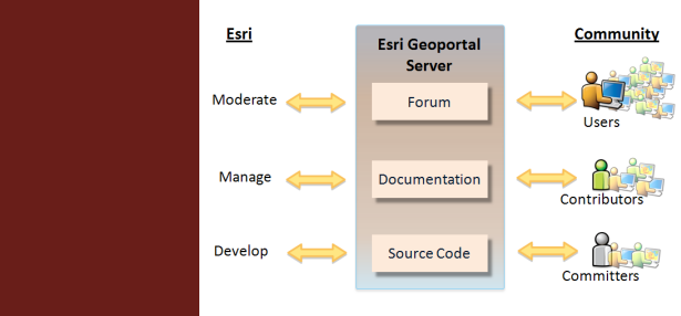
Esri's geoportal technology has been released as an open source project under the Apache 2.0 license. The latest releases, forums, documentation, and community can be found at the GitHub site.
Go to site...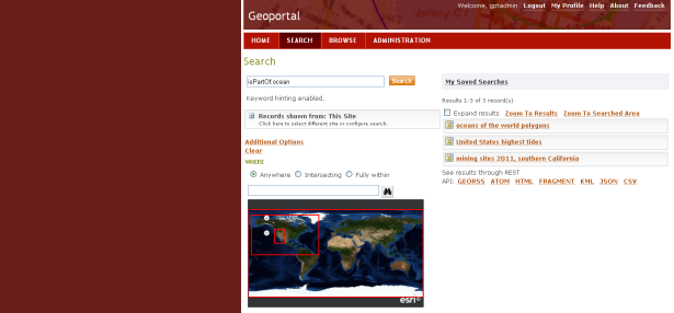
Esri hosts a public implementation of the latest Geoportal Server online for you to try. There you can register your metadata, search, and see whats new. On this site anyone who registers is automatically an administrator with the ability to register and approve content.
Go to site...