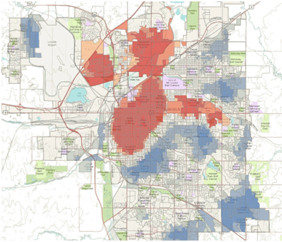
While there may be similarities between spatial and non-spatial (traditional) statistics in terms of concepts and objectives, spatial statistics are unique in that they were developed specifically for use with geographic data. Unlike traditional non-spatial statistical methods, they incorporate space (proximity, area, connectivity, and/or other spatial relationships) directly into their mathematics.
There are a ton of resources about using and understanding Spatial Statistics, and here on the Geoprocessing and Analysis team we want to make sure that everyone knows where to find them. We also want to make sure that everyone knows that if you have ArcGIS, you already have the Spatial Statistics toolbox, as well as the source code for most of the tools in it. The Spatial Statistics tools are not an extension, and with the exception of only 2 tools*, every tool in the toolbox is available at all license levels!
We've created a shortcut link to this article that is easy to remember: http://esriurl.com/spatialstats. We'll be updating this article as new resources become available, so check back often!
If you have any questions, there is now a Spatial Statistics Forum on the Resource Center. It's a great place to post your spatial stats questions so that everyone can benefit from the responses!
Last update: May 3rd, 2012
Spatial Pattern Analysis: Mapping Trends and Clusters
These tools can help you summarize and evaluate geographic distributions, identify statistically significant spatial outliers and clusters (hot spots), and assess broad geographic patterns and trends over time. These resources will help you find patterns and relationships in your data, facilitating discussion, contributing to research, and informing decision making.

Short Videos
Tutorials/Training
- Virtual Campus Training Seminar: Introduction to Spatial Pattern Analysis
- Esri User Conference Technical Workshop: Spatial Statistics Best Practices. This workshop walks through a real analysis from start to finish, from the gotchas of doing a hot spot analysis to the valuable new exploratory regression tool that helps you explore your data and find a properly specified model.
- Spatial Pattern Analysis in ArcGIS 10 Tutorial
- Hot Spot Analysis Tutorial for ArcGIS 10.1 and later versions
- Hot Spot Analysis Tutorial for ArcGIS 10.0
- Spatial Statistics ModelBuilder Tutorial for ArcGIS 10
Model and Script Tools
- Supplementary Spatial Statistics Toolbox currently includes:
- Exploratory Regression
- Incremental Spatial Autocorrelation
- Hot Spot Analysis - Case Study
Presentations
Articles and Blogs
Modeling Spatial Relationships Using Regression Analysis
Regression analysis helps you examine, model, and explore data relationships. Ultimately, regression analysis helps you answer “why?” questions: “Why do we see so much disease in particular areas?”, “What are the factors that contribute to consistently high childhood obesity rates?”, and “Why are screening rates so low in particular regions of the country?”. Regression analysis also allows you to predict spatial outcomes for other places or other time periods: “How will improvements to road conditions impact traffic fatalities?” or “How will projected population growth affect the demand for health services?”. These resources will help you learn about basic regression analysis concepts and workflows as they relate to the analysis of geographic data. Learn how to build a properly specified OLS model, interpret regression results and diagnostics, and potentially use the results of regression analysis to design targeted interventions.
 Tutorials/Training
- Supplementary Spatial Statistics Toolbox for ArcGIS 10
- Exploratory Regression
- Incremental Spatial Autocorrelation
General Resources for Spatial Statistics Users
Presentations- Mitchell, Andy. The ESRI Guide to GIS Analysis, Volume 2 . ESRI Press, 2005.
- Fotheringham, Stewart A., Chris Brunsdon, and Martin Charlton. Geographically Weighted Regression: the analysis of spatially varying relationships. John Wiley & Sons, 2002.
*Geographically Weighted Regression (GWR) requires either an ArcInfo License OR the Spatial Analyst Extension OR the Geostatistical Analyst Extension
*Generate Network Spatial Weights requires the Network Analyst Extension
